.....................MacGregor Index Page.......... 2015 Bahama Trip Index Page
....................................Previous Page......................................Next Page If There Is One
=========================================================
|
...................................--- Mangrove Cay ---................................ ..........................................................--- To --- ...........................................--- West End ---
|
.....................................................................................................
===============================================
|
.............................................................(May 30th) Anchorage --- N 26º 42.376´ ==== Trip Mileage = 1203 miles 7................W 78º 59.213´ ==== Day's Mileage = 29 miles |
===============================================
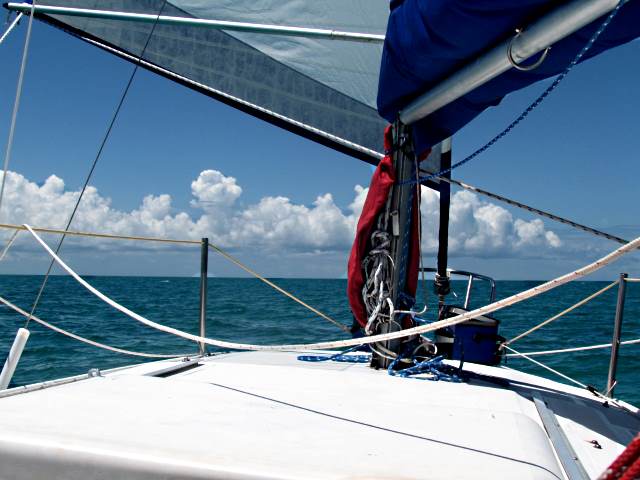
Pulled the anchor up around 7:30 with no noticeable wind but started to drift west away from the Cay so that was good. About 20 minutes later drifting west at about 1/2 knot I started to see ripples on the water and ...
... over a span of only 3-4 minutes the wind came up and I was sailing west at close to 4 knots. Unlike the day before the wind remained low but steady and from the same direction and I managed to run along consistently at just under 4 knots. It was a comfortable ride running with no drama, almost a perfect sailing day.
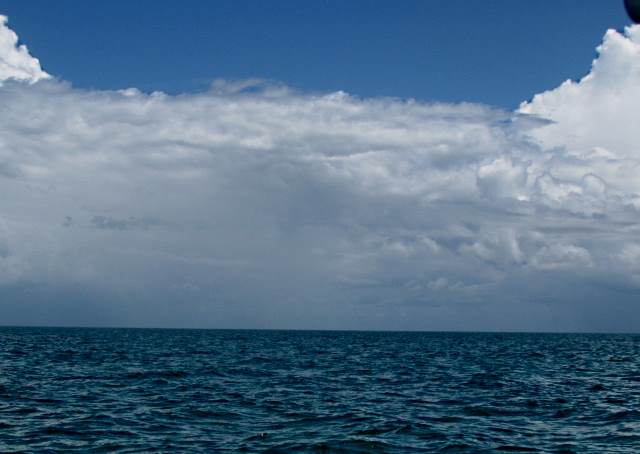
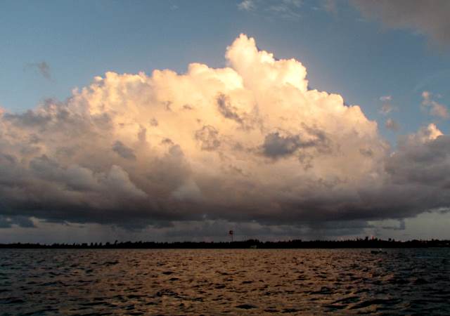
Just before noon the wind slackened some and dropped the boat speed to the high 2's. That was ok as I only had about 17 miles left before I dropped off the west end of the bank and into the Straits of Florida. There was a persistent cloud bank all day to the south of me hanging over the west end of the Grand Bahama Island or the waters to the north of it. I couldn't be sure, but it also appeared that there was rain coming out of the cloud bank at times. I hoped it stayed south of me and it did.
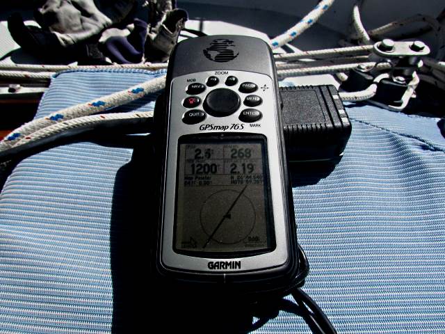
On this run, I also passed the 1200 mile mark since leaving the boatyard about 3 months previous.
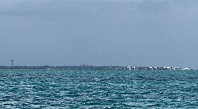
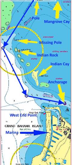
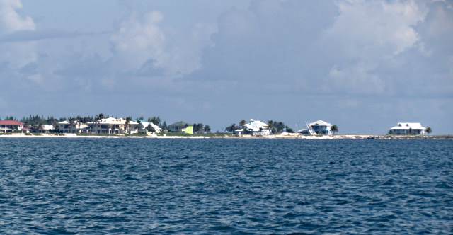
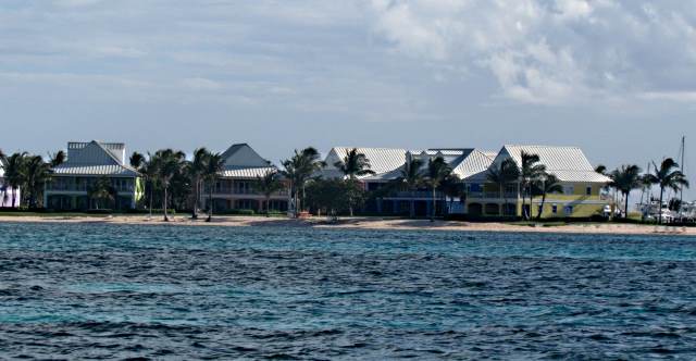
After a while I started to see the town of West End at, of course, the far west end of Grand Bahama Island. The chart showed an "incomplete surveyed" route into the West End anchorage across the waters above but I didn't feel good about it since the chart also showed waters under 3 feet deep in places. I decided to take the safer route and head west to Indian Rock and out into the Straits of Florida.
Once out it would be south and back in again by West End as shown above.
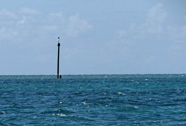
I passed a marker pole about 3/4's of a mile before Indian Rock and the water shallowed to about 7 feet and the winds became flaky. With the flaky winds came changing boat speeds between 2 and 4 knots.
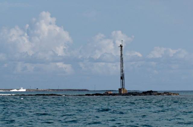
Then I passed Indian Rock and boat speeds went up so maybe I was dealing with a tidal current.
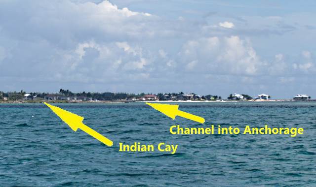
Once past Indian Rock the water quickly deepened as I was now on the edge of the Straits of Florida. I turned south on a broad reach and passed Indian Cay on my port side and headed for the channel on the north side of West End that led into an anchorage.
Arriving at the channel ....
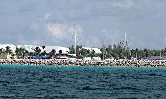
... I made a turn to the east and ran along the breakwater of the marina there. I dropped the sails and went on the outboard.
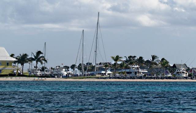
There is only 6-8 feet of water for about .4 of a mile in and the deeper water isn't that wide north/south.
I must of gotten slightly out of the channel as the rudder hit bottom and kicked up. Nice thing about this model of Mac (S) is that the rudder and centerboards both swing up so you have good warning before you are in water shallow enough for the hull to hit bottom. A stock Mac S can float in about 18 inches of water. Heavily loaded as I was the bottom greets you a little sooner at 21-22 inches.
With the same cloud that I had seen for most of the day still south of me I dropped the anchor about .4 of a mile in. I didn't want to be in further than that as I would be leaving in the middle of the night and didn't want to make my exit from here any more complicated than necessary. One strange thing was I dropped the anchor with the wind on the bow and waited to float back on the road so I could set the anchor. The boat didn't float back as it normally would because the tide was coming in and countered the force of the wind. I finally used the outboard to back down and set the anchor.
I had the anchorage all to myself. It was kind of hard to believe, as there had been a lot of boats waiting here just a day or so before. I did not like this anchorage as there is no real protection here from anything other than maybe a southeast wind. I decide then and there that if I was goiing to exit from this area again I would probably run overnight from Mangrove Cay and just keep going and exit the banks a little to the north of West End at Memory Rock and just keep going on to Florida. Single handed it would be a pain but with two people it made more sense to me vs. going to West End and then leaving in the early morning.
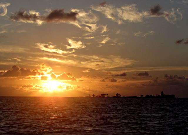
About 7 pm, with the sun going down I climbed in the V-Berth and tried to sleep. I needed some rest as I was getting up at 1:30 am to make the crossing of the Straits of Florida. One more day and hopefully I would be back in Florida. I needed to cross the next day to remain ahead of the next storm system.
=========================================================
.................................................................Next Page If There Is One...